Monday, July 19, 2010
July 19 - Yellowstone Park
This formation is at Mammoth hot spring, one of the two major stops along the route.
Also at Mammoth,, this curious formation called Liberty Cap. I see several things in this picture, and if you overlook the obvious fallous symbol, you can see an old man wearing a pointed hat.We then continued on to our lunch spot, and eventually to Old Faithful. Here is a picture of the hundreds waiting for the performance, and a little from the end of it's spirting cycle...I got the rest on video, but that will take a long time to add to the blog over this Wi-Fi connection, do I will have to leave it out for now.
Back at the hotel in W. Yellowstone, we gathered in a big room and had pizza delivered. And now, off to bed to prep for tomorrow. TTYL.
Sunday, July 18, 2010
July 18 - Shelby to W. Yellowstone
We stopped for a strech at Great Falls and, after some nice 75mph sweepers in the canyons, we stopped for Lunch in Helena. We went to fuel up at the famous Tim's Exxon, and I was looking forward to see what their full service treatment entailed for a motorcycle, but alas, it is closed up and only self-serve on Sundays. But if you are ever in Helena and need fuel, heck, even if you don't, fill up here and don't be afraid of the washrooms either.
Anyways, we headed down towards W. Yellowstone and got of the Interstate. There was about nine miles of con-str-str-str-struction and grav-av-av-el-el, but once through, things were smooth sailing. It did get pretty hot, and the next stop had some cooling vests coming out of storage.
We are now at W. Yellowstone, going out for something to eat in about an hour.
Saturday, July 17, 2010
And.......They're off!!!
Saturday, May 15, 2010
May 15 - Homeward Bound
Click the link below to see where I am located. http://maps.google.com/maps?f=q&hl=en&geocode=&q=53.4894,-113.52673&ll=53.4894,-113.52673&ie=UTF8&z=12&om=1
On our way once again, We headed over to Lake Louise for a peek, and then headed up the Icefields Parkway.
What an incredibly beautiful day in the parkway, relatively warm with sunny skies, and a Springtime view with snow still clinging to the mountainsides giving just stunning views. I rarely make it through there without getting rained on at some point, so today was a really special ride. We dropped off the trailer at the crossing, and continued up the parkway to visit the obscure Panther Falls. Still some rotten snow on the trail and even worse when you go off trail here, like I do, to get to the real view of this little waterfall. It was a lot of work for me to get in and out today with my chest cold reducing my already out of shape respiratory system, but it was worth it. Now that Dave knows about the place, he says he will visit again in the summer.
After Panther Falls, we back-tracked to pick up the trailer and continued on to Nordegg where we stopped at the Miner's Cafe for lunch, then it was a pretty straight ride home from there. I decided to stop at a Hughs car wash to fill up and remove the evidence of the trip. The bike was pretty good at the beginning of the day, but we know we are back in Alberta when we see the bugs.
Friday, May 14, 2010
May 14 - Back to Canada
Latitude:51.08352
Longitude:-115.05799
GPS location Date/Time:05/14/2010 19:02:36 MDT
Click the link below to see where I am located.
http://maps.google.com/maps?f=q&hl=en&geocode=&q=51.08352,-115.05799&ll=51.08352,-115.05799&ie=UTF8&z=12&om=1
After getting up and breaking camp, we continued on to Troy and Libby and up highway 37 to the Libby Dam and Eureka where we finally stopped for something to eat. It had been nearly a whole day since we last officially ate, so we had a big meal that started with a mediocre Clam Chowder soup and the I had a steak sandwhich while Dave had a Halibut burger. We were both full, but again, we didn't realize that this might be our only meal for the day. We crossed the border back into Canada at Roosville, and then continued up to Elko, Fernie, and Sparwood, crossed over the Crows Nest to Longview where we made the requisite purchases, then continued up 22 to Bragg Creek and then West on the #1 to just about Canmore where we found a campground with SHOWERS.....what luxury. Dave had the campground manager plug in his helmet for a recharge, and then we were kind of stuck there for the night...no supper...again. Oh well, we had pepperoni from Longview :)
Thursday, May 13, 2010
May 13 - Cross over to the dark side...
Latitude:48.56183
Longitude:-115.97631
GPS location Date/Time:05/13/2010 20:50:43 MDT
Click the link below to see where I am located.
http://maps.google.com/maps?f=q&hl=en&geocode=&q=48.56183,-115.97631&ll=48.56183,-115.97631&ie=UTF8&z=12&om=1
We started the day off breaking camp and double checking Dave's tires. All is OK. We then went to Osoyoos and dropped in on the Leesure Lite camper factory, Dave was trying to get them to sell him an axle, but no dice. We didn't get to actually see Todd and Susan's new trailer, but we did offer to pull it back to Edmonton...they didn't seem interested. Dave got some shiny hubcaps for his combi-camp though. Afterwards, we visisted to model train museum almost next door to the factory. My brother-in-law Ron could spend the whole day there no problem.
After we were all trained up, we left for the big old U S of A, riding down to Tonasket to catch highway 20 over to Republic, where we stopped fo a big Chicken Fried Steak lunch. Then we continued on Highway 20, nice pavement, quite curvy, over to Kettle Falls, tested the endurance of Dave's gas tank, finally found a station and got to Newport, then highway 2 to priest River, Sandpoint, Bonners Ferry, Moyie River, and finally a no services campground for the night. I hadn't realized that lunch was, in fact, lunch and supper, so I finally guilted Dave into giving me a powerbar he had stashed in his bike somewhere for who knows how many years. Note to self: throw an Ichiban soup in the bike somewhere.
Wednesday, May 12, 2010
May 12 - Visit Penticton and Summerland
Latitude:49.18445
Longitude:-119.54833
GPS location Date/Time:05/12/2010 20:46:26 MDT
Click the link below to see where I am located.
http://maps.google.com/maps?f=q&hl=en&geocode=&q=49.18445,-119.54833&ll=49.18445,-119.54833&ie=UTF8&z=12&om=1
Well, the mandatory tire pressure check indicated two problems. Dave's front tire is still leaking, and neither one of us has what we would consider an ideal tire gauge. We really started looking for the leak, putting spit in the schrader valve, and putting liquid on all the tire and along the rim seals. No Bubbles to be found. Then I said to Dave to give that valve stem a wiggle, and voila, psss...pssss...pssss. And just like that, our agenda for the day became clear. We grabbed the Gold Book and looked up the Honda dealer in Pentiction. We confirmed that they had a replacement valve in stock and could sqeeze us in, so off to Penticton we went. I find it ironic that both Dave's brother and him had valve replacement surgery within a week, and both patients are doing well. And while Dave was in the parking lot, the Mack tools guy was there and sold him a great tire guage. It's a bit big for my taste, but it works really well and I am told they make a smaller version. While the bike was in the shop, Dave threw caution to the wind and we rode 2-up over to a restaurant for lunch. I must have done OK because he got back on for the return trip.
After we got the bike back, we continued to Summerland where Dave has a brother-in-law, and we visited for a few hours before retunring to Oliver for the night.
Sorry, no pictures today.
Tuesday, May 11, 2010
May 11 - Nanaimo to Oliver
Latitude:49.1845
Longitude:-119.54889
GPS location Date/Time:05/11/2010 22:06:36 MDT
Click the link below to see where I am located.
http://maps.google.com/maps?f=q&hl=en&geocode=&q=49.1845,-119.54889&ll=49.1845,-119.54889&ie=UTF8&z=12&om=1
Well, it was time to move on from the Island and become boat people once again. But what boat to take? It was between going South and continuing into the States, or to begin our journey home and cross over to Vancouver. Well, I decided I really wanted to meet Lucille when she arrives home, so we embarked on the ferry to Horseshoe Bay. On the other side, Dave felt his front tire was low, so we pulled into a parking lot to check, and sure enough, it only had about ten pounds. I pulled out my compressor and topped him up, and we checked the rest too, but his front was the only alarming one. Then we were on our way and we met Dave's daughter Sherry for lunch again before heading out towards Hope. We checked Dave's tire again, and it is definately leaking, but no obvious nails or anything. Then we got on ther Hope Princeton highway and made our way to Princeton, then down to Osoyous, then up to Oliver, where we set up camp for the night. The road was delightful, if a bit unchallenging. Good pavement and nice wide sweeping turns, and tons of orchards and scenery.
Monday, May 10, 2010
It's called Fishing
Sunday, May 9, 2010
Destination Highway #4
Latitude:49.11555
Longitude:-123.93089
GPS location Date/Time:05/09/2010 21:18:11 MDT
Click the link below to see where I am located.
http://maps.google.com/maps?f=q&hl=en&geocode=&q=49.11555,-123.93089&ll=49.11555,-123.93089&ie=UTF8&z=12&om=1
Our original plan was to ride up to Port Hardy today, but we became aware of the location of DH4 west of Campbell River into Gold River, so we decided to do that instead. We also continued on to Muchalet Inlet. There we met this Turkish guy who told us all the history of the area - twice. Apparrently, all the world's problems can be blamed on the NDP, but I already knew that.
They were working in the inlet, bundling cedar logs, and the bundles were being moved around by these miniature tug boats. They were very manneuverable, and bobbed in the water like a cork. They look to be just about as much fun as riding the road up there.
I found that this highway did test my skills, particularly on downhill left turns, but I did not find the road in it's entirety to be as satisfying as Destination Highway #5 between New Denver and Kaslo. Dave says his favourite is DH3 to Lilloet, and after that, he likes the road to Tofino we were on Yesterday. I still like good old #5. But that is not to say you should avoid #4, it was a very entertaining road and should not be missed if you are ever in the area.
Going salmon fishing tomorrow.
Saturday, May 8, 2010
May 8 - Nanaimo - Tofino - Nanaimo
Latitude:49.11576
Longitude:-123.931
GPS location Date/Time:05/08/2010 21:59:37 MDT
Click the link below to see where I am located.
http://maps.google.com/maps?f=q&hl=en&geocode=&q=49.11576,-123.931&ll=49.11576,-123.931&ie=UTF8&z=12&om=1
Just a wonderful ride out to Tofino and back today. I have to say, if you ever have a chance to ride that highway to Tofino, don't pass it up. It was very entertaining, and should rate high on the destination highways rankings. We were very lucky with very light traffic almost magically aligned with passing opportunities.
We stopped for lunch, and then went over to long beach and Ucluelet before returning to Nanaimo. Dave's brother is back at home convalescing, so we have moved over to friend Wally's house for the weekend. We plan to ride up to Campbell River and Port Hardy tomorrow, and have tentative plans to go salmon fishing on Monday.
Friday, May 7, 2010
May 7 - Nanaimo-Courtney-Nanaimo
Latitude:49.23926
Longitude:-124.03017
GPS location Date/Time:05/07/2010 22:07:41 MDT Click the link below to see where I am located.
http://maps.google.com/maps?f=q&hl=en&geocode=&q=49.23926,-124.03017&ll=49.23926,-124.03017&ie=UTF8&z=12&om=1
and then headed North to Parkville, Courtney, and back to Nanaimo. On our way back we got a bit hungry, and so we searched high and low for someplace to eat, and all we could find was this upscale seafood restaurant. It was a little rouugh for us "Meat and Potatoes" Alberta boys to be forced to eat seafood, but we toughed it out. And then to make matters worse, we got off the beaten track on the way in to Nanaimo, and the road twisted and turned all over the place. You would think that in this day and age, they could engineer a straight road. ;)
Thursday, May 6, 2010
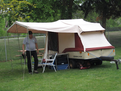
May 6 - Combi-Camp Cleanup
Wednesday, May 5, 2010
May 5 - Combi-Camp
Tuesday, May 4, 2010
May 4 - Victoria and Combi-Camp pickup
Latitude:49.23895
Longitude:-124.03022
GPS location Date/Time:05/04/2010 22:36:19 MDT
Click the link below to see where I am located.
http://maps.google.com/maps?f=q&hl=en&geocode=&q=49.23895,-124.03022&ll=49.23895,-124.03022&ie=UTF8&z=12&om=1
Today we drove down to Victoria. Dave visited his brother in the hospital after his surgery yesterday. Everything on that front appears to be going well. Then we picked up his combi-camp trailer and hauled it back to Nanaimo. Tomorrow, we have to give it the once over and make sure the lights work with the bikes.
The weather was a bit funny today. There was one point, where we were in driven rain and sleet, wishing we had sunglasses. But we were not on the bikes today, so we were nice and dry, and when the sun was shining and we see all the green grass annd flowers, we thank our lucky stars we left Edmonton when we did.
Monday, May 3, 2010
May 3 - Pacifica
Sunday, May 2, 2010
Check-in/OK message from Nanaimo
Latitude:49.23891
Longitude:-124.03041
GPS location Date/Time:05/02/2010 19:22:33 MDT
Click the link below to see where I am located.
http://maps.google.com/maps?f=q&hl=en&geocode=&q=49.23891,-124.03041&ll=49.23891,-124.03041&ie=UTF8&z=12&om=1
We rode in a light rain from Hope into port Moody and had a brunch with Dave's two daughters Sherri and Darcy, and Sherri's husband Todd. After lunch, as we rode over to Horseshoe Bay, I realized that I forgot to thank them for lunch, so Todd and Sherri, Thanks for lunch. it was very nice meeting you again.
We rode the ferry over to the Island and are staying at Dave's brother Rob's house. On the ferry, we met some Harley riders returning home from their weekends away, including this nice Road King Police Special with a sidecar.
Despite the rain today, it was still about ten degrees warmer than when we left Alberta, and it doesn't feel really cold. The scenery is nice, with lots of flowers and trees in full bloom. I could get used to that really easy. What a beautiful place to live.